LUCERNE, Switzerland
// 3 aerial photographs and 3 video clips
LUCERNE, Switzerland from above: the Kapellbrücke and Wasserturm on the turquoise Reuss, the Museggmauer towers and Altstadt roofs under heavy grey overcast.
LUCERNE, Switzerland is a drone session in flight_log: 3 aerial photographs and 3 video clips, each one pinned where it was shot on a 3D reconstruction of the real terrain, built from elevation and map data.
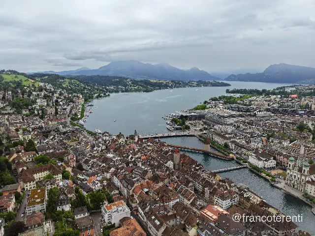 LUCERNE, Switzerland - aerial drone photograph (1 of 3) - Dense old-town rooftops crowd the foreground, split by the turquoise Reuss where the Kapellbrücke and its octagonal red-capped Wasserturm sit just below the Seebrücke; the twin-towered Jesuitenkirche stands on the right bank and the KKL's dark cantilevered roof marks the lakefront, with the wide teal lake and hazy wooded ridges under heavy grey overcast beyond. Aerial drone photograph over LUCERNE, Switzerland from 47.05237640622846, 8.311843872070314 on 2026-06-12. Exposure 220 · f1.8 · 9mm.
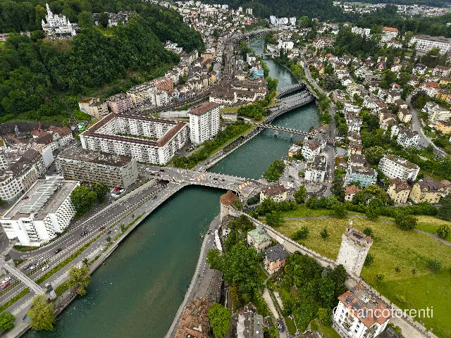 LUCERNE, Switzerland - aerial drone photograph (2 of 3) - The green-tinted Reuss curves between steep wooded slopes and packed apartment blocks, passing under the Geissmattbrücke and further road and rail crossings; the squat round Nölliturm anchors the water's edge, while the Museggmauer climbs the mown lawn on the right to the battlemented Männliturm and the turreted Château Gütsch crowns the trees upper left. Aerial drone photograph over LUCERNE, Switzerland from 47.054510846333585, 8.294591903686525 on 2026-06-12. Exposure 110 · f1.8 · 9mm.
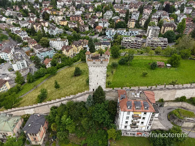 LUCERNE, Switzerland - aerial drone photograph (3 of 3) - The whitewashed Männliturm rises from a grassy ridge, its red-tiled cap topped by the small armoured figure that gives it its name, with the crenellated Museggmauer running downhill past mature trees and pastel townhouses and balconied apartment blocks stacked on the slope beyond. Aerial drone photograph over LUCERNE, Switzerland from 47.053224344717066, 8.301630020141603 on 2026-06-12. Exposure 100 · f1.8 · 9mm.
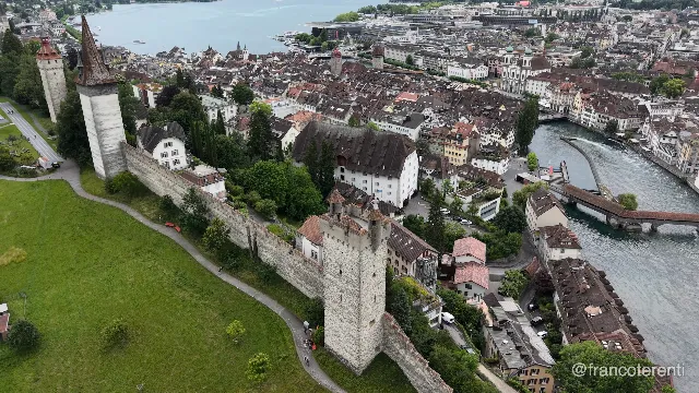 LUCERNE, Switzerland - aerial drone video (1 of 3) - The Museggmauer runs along a green hillside with its square battlemented towers — the round Nölliturm and spired Männliturm at the left, a taller keep in the foreground — above the tight tiled roofs of the Altstadt, with the covered Spreuerbrücke, a slender steel footbridge over the Reuss weir and the Jesuitenkirche domes on the right under flat overcast light. Aerial drone video over LUCERNE, Switzerland from 47.054598561222726, 8.306393623352053. Exposure 100 · f2.8.
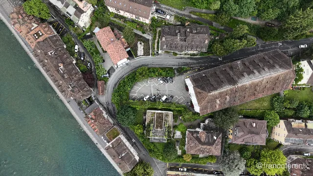 LUCERNE, Switzerland - aerial drone video (2 of 3) - Straight-down framing of tiled roofs and a stone quay wall along the milky turquoise Reuss, with a road curling around a small car park of marked bays and parked cars, a long dark-roofed hall alongside, and clipped hedges, garden trees and a rooftop terrace filling the gaps. Aerial drone video over LUCERNE, Switzerland from 47.05591426724654, 8.300814628601076. Exposure 100 · f2.8.
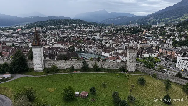 LUCERNE, Switzerland - aerial drone video (3 of 3) - The spired Männliturm and a second battlemented tower anchor the crenellated Museggmauer across a mown hilltop with scattered trees and a small shed; below spread the tiled roofs and church steeples of the Altstadt along the green Reuss, backed by forested slopes and layered blue peaks under low cloud. Aerial drone video over LUCERNE, Switzerland from 47.050154158639906, 8.299913406372072. Exposure 100 · f2.8.