SAN JUAN, Argentina
// 5 aerial photographs
San Juan, Argentina from above: the Circunvalación ringing a lit grid at night, hazy sunrise over the ridges, and desert scrub beyond the last streets.
SAN JUAN, Argentina is a drone session in flight_log: 5 aerial photographs, each one pinned where it was shot on a 3D reconstruction of the real terrain, built from elevation and map data.
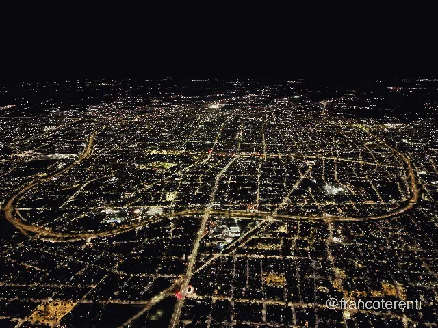 SAN JUAN, Argentina - aerial drone photograph (1 of 5) - A vast grid of city lights stretching to a black horizon at night, the lit arc of the Circunvalación ring road curving through the lower half and streets glowing amber against dark blocks of low rooftops and unlit tree canopy. Aerial drone photograph over SAN JUAN, Argentina from -31.52982402108432, -68.55520248413087 on 2026-02-24. Exposure 1070 · f1.8 · 9mm.
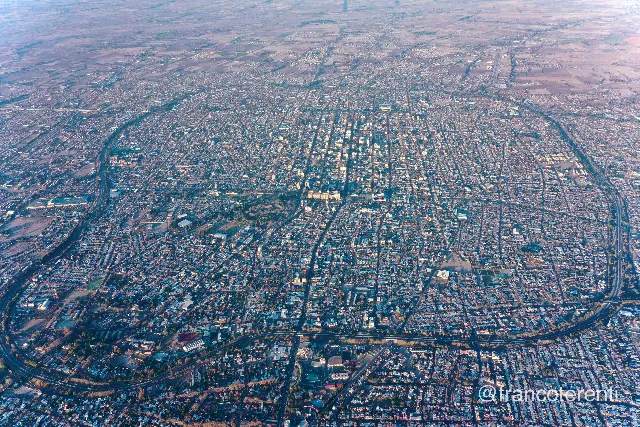 SAN JUAN, Argentina - aerial drone photograph (2 of 5) - A dense low-rise grid seen from high altitude in cool early light, a compact cluster of taller white buildings marking the centre, the Circunvalación and a rail corridor curving around the edges as tree-lined bands, and pale ploughed fields dissolving into haze at the horizon. Aerial drone photograph over SAN JUAN, Argentina from -31.55791298093802, -68.51503372192384 on 2024-07-25. Exposure 100 · f5 · 10mm.
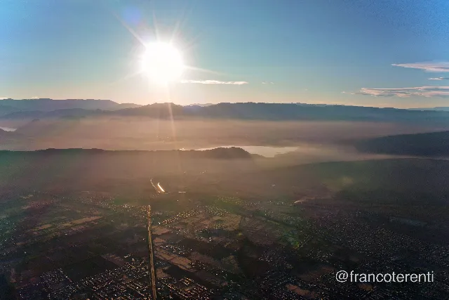 SAN JUAN, Argentina - aerial drone photograph (3 of 5) - Sunrise over layered mountain ridges, the low sun flaring through dust and haze that fills the valley floor in bands of gold and rose; a reservoir glints in the middle distance above a broad plain of streets, fields and a straight highway running toward the camera. Aerial drone photograph over SAN JUAN, Argentina from -31.5125568213132, -68.52567672729494 on 2024-07-25. Exposure 100 · f6.3 · 10mm.
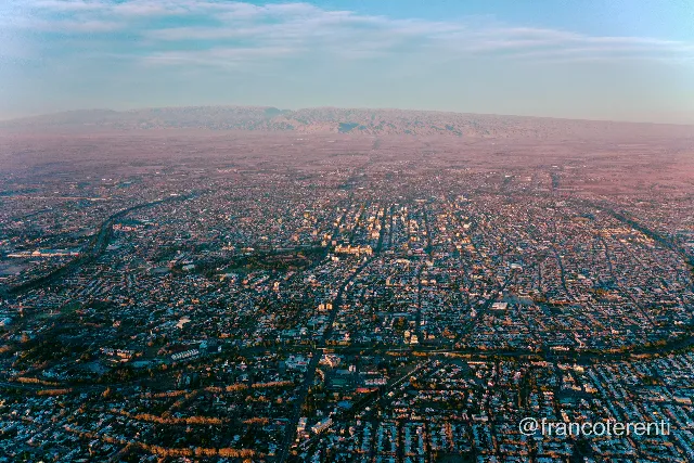 SAN JUAN, Argentina - aerial drone photograph (4 of 5) - A wide grid of low buildings under a pale blue sky, warm sunset light raking across rooftops and yellowing tree lines, the Circunvalación tracing a green-edged curve around the left and lower edges, with a long arid ridge and dusty plain fading into pink haze on the horizon. Aerial drone photograph over SAN JUAN, Argentina from -31.556011391095595, -68.5455894470215 on 2024-07-25. Exposure 100 · f2.8 · 10mm.
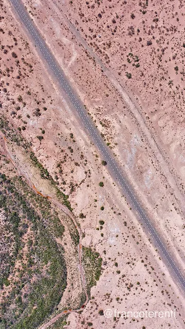 SAN JUAN, Argentina - aerial drone photograph (5 of 5) - Straight down over dry desert scrub, a two-lane asphalt road cutting diagonally across pale pink sand and gravel dotted with dark bushes, with a rust-coloured dry stream channel and denser green vegetation along a low ridge at lower left. Aerial drone photograph over SAN JUAN, Argentina from -31.5413824811742, -68.49769592285158 on 2024-12-21. Exposure 100 · f4 · 10mm.