VADUZ, Liechtenstein
// 6 aerial photographs
VADUZ, Liechtenstein under flat overcast: the covered timber Rhine bridge, the castle white on its wooded bluff, and St. Florin's spire above the Städtle.
VADUZ, Liechtenstein is a drone session in flight_log: 6 aerial photographs, each one pinned where it was shot on a 3D reconstruction of the real terrain, built from elevation and map data.
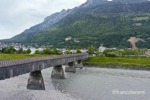 VADUZ, Liechtenstein - aerial drone photograph (1 of 6) - The Old Rhine Bridge, a long covered timber crossing on tapered stone piers, spans a wide pale grey-green river running over gravel banks; low industrial and residential buildings line the far shore beneath a steep forested ridge, with Vaduz Castle small and white on its rocky bluff under flat overcast light. Aerial drone photograph over VADUZ, Liechtenstein from 47.130505495495214, 9.512143135070803 on 2024-05-12. Exposure 100 · f5 · 10mm.
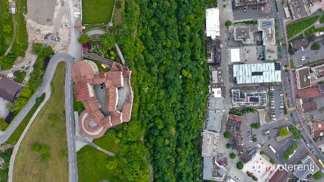 VADUZ, Liechtenstein - aerial drone photograph (2 of 6) - Straight down on Vaduz Castle: red-tiled roofs, square keep, round bastion and curtain walls wrapped around an inner courtyard, ringed by a hairpin road and mown terraces, with a dense wooded scarp separating it from the flat-roofed shops, glass canopies and parking of the Städtle pedestrian centre below. Aerial drone photograph over VADUZ, Liechtenstein from 47.14050440064906, 9.521552324295046 on 2024-05-12. Exposure 100 · f4.5 · 10mm.
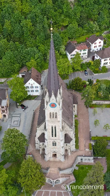 VADUZ, Liechtenstein - aerial drone photograph (3 of 6) - The Cathedral of St. Florin seen at a steep angle: grey stone Gothic Revival nave and tall dark spire with a gilded finial and blue clock face, rising from a paved terrace of steps and low walls among white shuttered houses, lawns and heavy deciduous woodland. Aerial drone photograph over VADUZ, Liechtenstein from 47.13630800882749, 9.52246427536011 on 2024-05-12. Exposure 100 · f4.5 · 10mm.
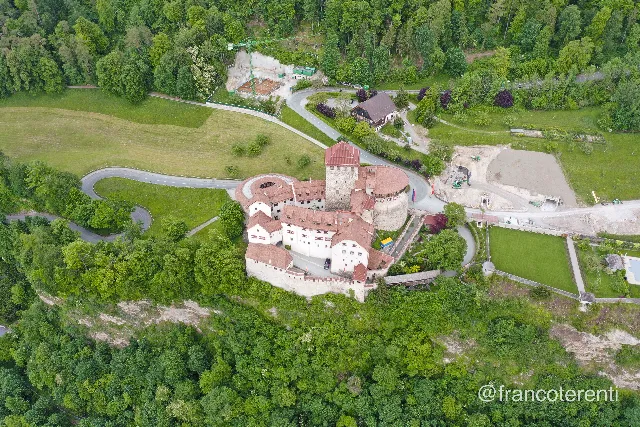 VADUZ, Liechtenstein - aerial drone photograph (4 of 6) - Vaduz Castle on its wooded rocky bluff — white walls, red tile roofs, square keep, round bastion and crenellated curtain walls — encircled by a hairpin road, sloping green meadows and mature trees, with a construction site, crane and bare earth on the plateau behind. Aerial drone photograph over VADUZ, Liechtenstein from 47.13934404021297, 9.523719549179077 on 2024-05-12. Exposure 100 · f4 · 10mm.
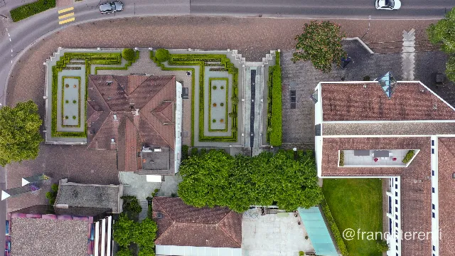 VADUZ, Liechtenstein - aerial drone photograph (5 of 6) - Straight down on a red-tiled hipped-roof villa flanked by symmetrical clipped-hedge parterres and two shallow rectangular basins, with broad paved plazas, conical topiary and a stepped ramp; the black cube of the Kunstmuseum Liechtenstein, its glass band shot with pink, sits at the lower left among leafy trees. Aerial drone photograph over VADUZ, Liechtenstein from 47.13615474303139, 9.519621133804321 on 2024-05-12. Exposure 100 · f4.5 · 10mm.
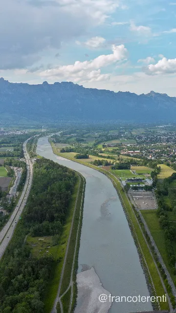 VADUZ, Liechtenstein - aerial drone photograph (6 of 6) - The channelled Rhine, silt-pale with exposed gravel bars, runs straight between raised embankments down a wide green valley — motorway and woodland belts on one side, the Rheinpark Stadion, its training pitches and car park, farm plots and a spread-out town on the other — backed by a long hazy blue mountain wall under scattered cumulus. Aerial drone photograph over VADUZ, Liechtenstein from 47.137570610242776, 9.510040283203127 on 2024-05-12. Exposure 100 · f5.6 · 10mm.